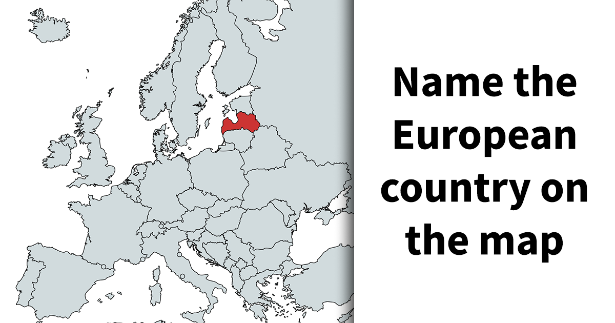
Europe map quizzes look easy right up until the moment your confidence trips over a coastline. France? Italy? Croatia? Wait, why does that country look like a boomerang that went to art school? That is exactly why this kind of geography challenge is so irresistible. It turns a continent packed with peninsulas, islands, mountain chains, and famously tiny states into one giant brain teaser.
If the title “France Or Italy? Test Your Europe Knowledge By Naming 35 Countries On The Map” made you smirk and then quietly panic, welcome to the club. Europe rewards the bold, punishes the overconfident, and absolutely loves making one shoreline look suspiciously like another. The good news is that once you learn the continent by pattern instead of panic, naming countries on a blank map becomes far less terrifying and a lot more fun.
This is not just a trivia game for people who own atlases for entertainment. A Europe map quiz trains visual memory, spatial reasoning, and cultural awareness all at once. It makes you notice how France spreads out like a rough hexagon, how Italy dangles into the Mediterranean like a boot, how Scandinavia stretches north in dramatic style, and how the Balkans become a glorious blur until you slow down and read the borders carefully.
Why a Europe map quiz is harder than it looks
Europe is the second-smallest continent by area, but it punches way above its weight in geographic complexity. That is part of the charm. On one map, you get Atlantic coasts, Arctic reaches, Mediterranean shores, Alpine walls, river plains, and a patchwork of countries whose shapes are memorable only after repeated exposure. In other words, Europe is a compact continent with main-character energy.
A second reason these quizzes are tricky is that the exact number of European countries can vary by definition. Some classroom resources count 44 sovereign states, while broader geopolitical or continental definitions push the total higher. That means a 35-country challenge is not trying to include every possible case. It usually focuses on the most recognizable sovereign states and leaves out a few microstates or edge-case transcontinental entries. So if you do not see every tiny dot on the map, relax. The quiz is testing recognition, not your ability to spot Vatican City from outer space.
Then there is the shape problem. Europe is a continent of peninsulas, and peninsulas love drama. The Iberian Peninsula gives you Spain and Portugal. The Italian, or Apennine, Peninsula gives you Italy’s famous boot. The Balkans give you a dense cluster of southeastern countries that love to humble even confident players. Scandinavia and Fennoscandia add long northern forms, while islands like Iceland, Ireland, and the United Kingdom make you shift from continental logic to offshore awareness.
France or Italy? The visual clues that save your score
Let us start with the title’s central showdown. France and Italy are both iconic, both culturally huge, and both tied to the Alps and the Mediterranean world. But on a map, they should not be mistaken for long.
How to spot France fast
France is often described as roughly hexagonal in shape, and that nickname exists for a reason. On the European map, it sits in Western Europe with Spain and Andorra to the south, Belgium and Luxembourg to the northeast, Germany, Switzerland, and Italy to the east, and coastlines on the Bay of Biscay, the English Channel, and the Mediterranean. Once you see that broad, balanced outline, France usually stops being mysterious and starts feeling like the anchor of Western Europe.
Another clue is positioning. France feels central to Western Europe without being boxed in. It is large, confident, and bordered by enough famous neighbors that it becomes easier to identify by context. If a country has Spain under it, Germany to one side, and a Mediterranean edge down south, congratulations, you have probably found France.
How to spot Italy without embarrassing yourself
Italy, by contrast, is the rock star of outline quizzes. It is the boot-shaped peninsula extending into the Mediterranean, with the Alps protecting the north and the Apennines running down the spine of the country. The Adriatic Sea sits to the east, while the Tyrrhenian and Ligurian seas lie to the west. Sicily hovers near the toe like a dramatic punctuation mark, because Italy never misses an opportunity to be visually memorable.
Italy is also easier to lock down once you remember its neighbors: France, Switzerland, Austria, and Slovenia to the north. If the country on your map looks like footwear ready to kick southward into the sea, it is not France. It is definitely Italy. Geography is generous that way.
How to name 35 countries on the map without guessing wildly
The smartest way to tackle a Europe map quiz is not alphabetically. It is regionally. Think in clusters. Your brain remembers groups better than isolated facts, and Europe rewards that strategy.
1. Start with the easy anchors
Begin with countries almost everyone can place: Portugal, Spain, France, Italy, Germany, the United Kingdom, Ireland, Norway, Sweden, Finland, Poland, and Greece. These are the big visual anchors. Once they are placed, the smaller or trickier countries become easier to locate by proximity.
For example, Denmark becomes easier once you remember it sits on the Jutland Peninsula above Germany. Norway and Sweden make more sense when you picture the Scandinavian Peninsula, with Norway’s dramatic western fjord coast and Sweden stretching beside it. Finland then appears to the east, tied to Scandinavia but also bordering Russia and the Baltic Sea.
2. Build out Western and Central Europe
After the anchors, move inward. Belgium, the Netherlands, Luxembourg, Switzerland, and Austria are classic second-wave answers. They may be smaller than the continent’s headline countries, but they sit in logical positions once you have France, Germany, and Italy fixed in place.
Germany is especially helpful because it is a geography overachiever. It borders more neighbors than any other European country, which makes it a perfect reference point. Once Germany is on your map, nearby states such as Denmark, Poland, Czechia, Austria, Belgium, the Netherlands, Luxembourg, France, and Switzerland fall into a more manageable pattern.
3. Do not panic in the Baltics
Estonia, Latvia, and Lithuania are where many quiz-takers start squinting at the screen like detectives in a budget crime drama. Keep it simple. Think north to south along the eastern Baltic coast: Estonia, then Latvia, then Lithuania. If you can remember that vertical stack, you will save yourself a lot of unnecessary emotional damage.
The Baltic region also becomes easier when you relate it to Finland above, Sweden across the sea, Poland below, and Russia to the east. Context is your best friend here.
4. Respect the Balkans
The Balkans are where map quizzes separate the casual player from the person who mutters country names in the shower. This region is dense, historically layered, and easy to scramble if you rush. Slovenia sits at the northern gateway near Italy and Austria. Croatia curves along the Adriatic in a shape that feels like the map is trying to be clever. Bosnia and Herzegovina tucks in beside it. Serbia sits inland. Montenegro, Albania, North Macedonia, Bulgaria, Romania, Greece, and sometimes Moldova all require steady attention.
A helpful trick is to stop treating the Balkans like a blur. Learn them as a sequence. Start with the Adriatic coast, then move inland. Once you know who hugs the sea and who does not, the cluster becomes far more manageable.
5. Know what a 35-country quiz usually leaves out
Many Europe map challenges do not include every microstate, and honestly, that is probably merciful. Countries such as Andorra, Monaco, Liechtenstein, San Marino, Malta, and Vatican City can be essential to understanding Europe, but they are often omitted from medium-length quizzes because their size makes them harder to display clearly on standard maps. A 35-country version usually wants you to identify major sovereign states, not perform surgery with a cursor.
Common mistakes that wreck otherwise good scores
Mistaking France for Spain: Spain occupies most of the Iberian Peninsula and sits southwest of France. If the country touches Portugal, it is Spain, not France.
Mixing up Sweden and Norway: Norway has the dramatic Atlantic-facing coastline and famous fjords. Sweden lies to the east. Think “Norway hugs the ocean.”
Forgetting Denmark: Denmark is small compared with its neighbors, but its position just above Germany and its mix of peninsula and islands make it distinct.
Losing the Baltics: Estonia, Latvia, Lithuania. North to south. Repeat until your brain stops arguing.
Treating the Balkans like one giant mystery blob: They are not a blob. They are a regional masterpiece of borders, coastlines, and historical layers. Slow down and they become learnable.
Why these quizzes are so addictive
There is a reason geography games keep surviving every trend cycle. A good map quiz triggers curiosity, competition, and tiny jolts of satisfaction every time you get one right. You are not just memorizing names. You are building a mental picture of how the world fits together.
That is also why Europe is such a satisfying quiz subject. The continent is rich in instantly recognizable symbols, but the deeper you go, the more nuance you find. You start with France and Italy, then suddenly you are remembering where Slovenia fits, why Croatia’s coastline is so distinctive, and how Finland’s position differs from Sweden’s. It becomes part puzzle, part travel fantasy, part proof that your brain still enjoys a challenge.
Modern geography games have made that even more appealing. Silhouette-based country games, interactive map quizzes, and viral geography puzzles have turned location recall into a casual daily habit. One minute you are “just checking” whether you can identify Europe’s countries, and the next minute you are three quizzes deep, passionately defending your right to confuse Slovakia and Slovenia only once.
What a great score on this quiz actually says about you
If you can name 35 countries on a map of Europe, you are doing more than showing off. You are demonstrating pattern recognition, cultural curiosity, and a sense of spatial memory that transfers well beyond trivia. Travelers use it. Students benefit from it. Readers of world news rely on it. And yes, it also gives you a very specific kind of dinner-party confidence.
More importantly, it changes the way you see Europe. Countries stop being abstract names in headlines and start becoming real places with neighbors, coastlines, landscapes, and identities. France is no longer just Paris. Italy is no longer just Rome and pasta. Denmark is not just “somewhere up there.” The map becomes legible, and once that happens, the continent feels far more alive.
Experience: what it feels like to take a Europe map challenge
A Europe map quiz often begins with false confidence. The first few answers feel almost unfairly easy. France, Italy, Spain, Germany, the United Kingdom. Your brain stretches, yawns, and decides this is going to be a comfortable little victory lap. Then the map starts asking better questions. Denmark appears smaller than you remembered. Croatia curves in a way that seems personal. The Baltics line up like a test of whether you were truly paying attention or just coasting on vibes.
That is when the experience becomes memorable. Instead of passively reading geography facts, you begin interacting with the continent. You compare coastlines. You search for mountain barriers. You remember that Norway hugs the Atlantic, that Finland leans toward Russia, that Greece spills into islands and southern sunlight. Even the countries you miss leave an impression, because the mistake itself teaches you something. Confusing Slovakia and Slovenia once is frustrating. Confusing them twice feels like the map is roasting you in public.
There is also a strange thrill in watching Europe organize itself in your head. At first the continent feels crowded, almost noisy. But then patterns emerge. Western Europe starts looking solid and familiar. Central Europe becomes a network rather than a jumble. The Balkans, once intimidating, slowly turn into a sequence of places with their own logic. The whole exercise begins to feel less like memorization and more like developing a visual language.
For travelers, this kind of quiz has another payoff. It changes the emotional texture of future trips. When you already understand where countries sit relative to one another, flights, train routes, and travel stories make more sense. A mention of the Adriatic coast, the Alps, or the Baltic region lands differently because you can picture it. Europe feels connected rather than abstract. That sense of connection makes travel articles better, history easier to follow, and even sports tournaments more entertaining.
There is a social side to it too. Geography quizzes are sneaky crowd-pleasers. Families argue over spellings. Friends form temporary alliances to remember whether Moldova sits above or below Romania. Someone always gets overly dramatic about Iceland being “obvious,” and someone else insists that microstates deserve more respect. It is nerdy fun in the best possible way, the kind that invites laughter instead of pressure.
Most of all, a challenge like “France Or Italy? Test Your Europe Knowledge By Naming 35 Countries On The Map” reminds people that learning does not have to feel heavy. It can feel playful, fast, and oddly satisfying. You can start with one famous boot and one rough hexagon, then end up with a stronger understanding of an entire continent. Not bad for a quiz that begins with a tiny identity crisis over France and Italy.
And that is the real charm. A map quiz is never only about getting a score. It is about building familiarity. Every correct answer makes the map less foreign. Every mistake adds detail. Every replay sharpens memory. Eventually, Europe stops looking like a complicated patchwork and starts looking like a place you genuinely know. That is when geography becomes more than school knowledge. It becomes a way of seeing the world with more clarity, curiosity, and confidence.
Final thoughts
So, France or Italy? On a good day, you will know both instantly. On a bad day, the Mediterranean may briefly turn your confidence into mashed potatoes. Either way, the challenge is worth taking. A Europe map quiz is one of the simplest and smartest ways to sharpen your world knowledge while having a surprisingly good time.
If you want to score higher, remember the big anchors, study Europe by region, and trust patterns more than panic. Learn the hexagon. Learn the boot. Respect the Balkans. Befriend the Baltics. And never underestimate how helpful one memorable coastline can be. Name 35 countries correctly, and you are not just winning a quiz. You are training your brain to read a continent with style.