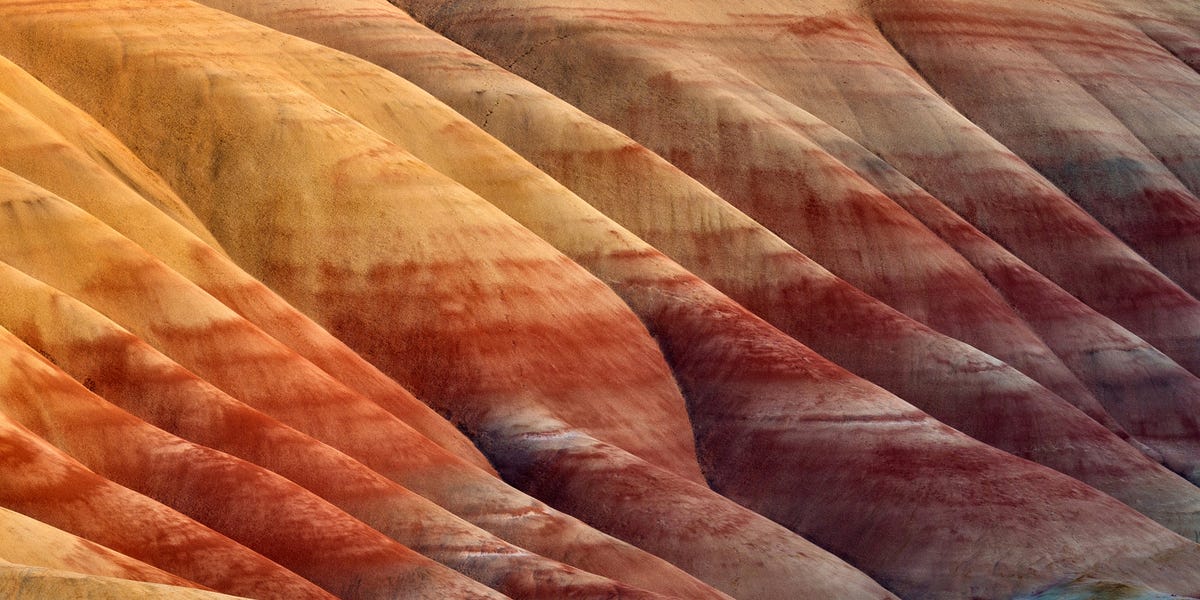
Geology usually operates like a dependable filing cabinet. New sediment lands on top, older material stays underneath, and every layer waits patiently for a geologist to arrive millions of years later with a notebook, a rock hammer, and an unreasonable enthusiasm for mud.
But beneath the northern North Sea, that filing system appears to have suffered a spectacular administrative failure. Scientists have identified hundreds of enormous buried structures in which younger, denser sand lies underneath older, lighter sediment. In other words, portions of the sedimentary record have been rearranged into an upside-down sequence.
The discovery does not mean Earth’s crust, mantle, and core have traded places. That would be a considerably more stressful Tuesday. Instead, the finding involves a localized phenomenon called stratigraphic inversion, hidden roughly a kilometer beneath the seabed. The structures may reveal a previously unrecognized way that earthquakes, pressure, buoyancy, and liquefied sediment can reorganize the shallow crust on a colossal scale.
What Did Scientists Actually Find Beneath the North Sea?
The discovery was reported by geoscientists Jan Erik Rudjord and Mads Huuse in the journal Communications Earth & Environment. Their study examined the northern North Sea, particularly areas of the Norwegian continental shelf containing mysterious sand-filled mounds that had puzzled researchers for decades.
These are not modest bumps that could be mistaken for an ambitious molehill. Some extend for several kilometers and belong to a population of hundreds of buried mounds and ridges. Earlier explanations suggested landslides, mud movement, sand injected upward from deeper reservoirs, or sand that had simply shifted without leaving its original layer. None of those models explained all the evidence.
The new interpretation is dramatically different: younger sand that was originally deposited above an older layer sank downward through it. As the sand descended, the older and lighter material rose into the space above. The researchers named the downward-moving sand bodies sinkites and the uplifted blocks of older sediment floatites.
It is a refreshingly direct naming system. The sand sank, so it became a sinkite. The ooze floated, so it became a floatite. Somewhere, a committee responsible for complicated geological terminology briefly took the afternoon off.
Why “Upside Down” Is Such a Big Deal in Geology
The Law of Superposition
One of geology’s most important principles is the law of superposition. In a sedimentary sequence that has not been disturbed, the oldest layer should be at the bottom and progressively younger layers should appear above it. It works much like stacking newspapers: yesterday’s edition goes down first, while today’s edition lands on top.
The principle allows geologists to reconstruct relative time even when they cannot determine an exact numerical age. Fossils found in a lower undisturbed layer are normally older than fossils in an upper layer. Volcanic ash, marine mud, river sand, and organic debris can therefore become pages in a chronological history book.
Geologists already know that folding, faulting, landslides, erosion, and tectonic collisions can disturb that order. An entire sequence can even be overturned by powerful crustal deformation. What makes the North Sea discovery unusual is the proposed mechanism and its enormous scale. The layers were not simply folded like a rug or flipped as one solid block. Two materials may have physically exchanged positions because their densities became unstable.
A Giant Version of a Small Sedimentary Process
Small load structures are familiar to sedimentologists. When a heavy layer rests on softer, water-rich sediment, the upper material can sag downward while the lower material pushes upward. This may produce shapes called load casts or ball-and-pillow structures.
The North Sea sinkites appear to represent something comparable, but enlarged from notebook-sized outcrops to formations spanning kilometers. The study describes them as orders of magnitude larger than conventional load structures and potentially part of a geological process that has not previously been documented at this scale.
How Scientists Saw Through the Seafloor
No research submarine drilled a giant window into the seabed. The team reconstructed the buried structures using three-dimensional seismic reflection imaging, petrophysical well logs, drill cuttings, and mineralogical measurements collected from hundreds of wells.
Seismic reflection surveys work by sending controlled sound energy into the subsurface. Waves reflect from boundaries where the physical properties of rock or sediment change. By recording the returning signals and processing vast quantities of data, geophysicists can create three-dimensional images of layers, faults, channels, and other structures that are impossible to observe directly.
It is essentially a medical scan for a sedimentary basin, except the patient is millions of years old, several thousand feet thick, and unwilling to remain inside an MRI machine.
The seismic images revealed sand-filled fractures connecting buried sand bodies to younger sandy units above them. Well samples also showed that sand inside the mounds resembled the overlying sand in appearance and mineral composition. In at least one investigated area, researchers found no plausible parent sand immediately below the mounds. The evidence suggested that the material had arrived from above rather than being injected upward from a deeper reservoir.
How Did Younger Sand Sink Beneath Older Sediment?
Step 1: Microscopic Life Created an Unusually Light Layer
During the Oligocene and Miocene epochs, fine sediment accumulated across the North Sea basin. Some of it was rich in microscopic marine organisms, including silica-producing plankton such as diatoms. Their remains helped form highly porous, biosiliceous ooze within what geologists call the Hordaland Group.
Although the word “ooze” sounds like something that should glow green and attack a small town, this material was not necessarily a free-flowing slime. It could become partly consolidated while remaining porous and relatively low in density.
Step 2: Denser Sand Arrived Above It
Later, extensive sand-rich deposits accumulated across parts of the basin, including sediments associated with the Utsira Group. This created an unstable arrangement: comparatively dense sand resting on lighter, porous ooze.
Under normal conditions, friction between grains and the strength of the sediment might have preserved the arrangement. The heavier sand would have remained where it was deposited, and the lighter ooze would have stayed underneath despite the density contrast.
Step 3: Shaking or Fluid Pressure Weakened the Sand
The researchers propose that earthquakes, repeated seismic activity, fluid expulsion, or sudden pressure changes caused water-saturated sand to lose its strength. This behavior is known as liquefaction. When pore-water pressure rises between loose grains, the grains lose contact and the sediment can temporarily behave like a dense fluid.
Modern earthquake liquefaction can make solid-looking ground flow, subside, crack, or eject sand. Beneath the ancient North Sea, liquefaction may have turned the overlying sand into a mobile slurry.
Step 4: Polygonal Faults Opened the Routes Downward
The older ooze was cut by networks of polygonal faults, which can develop as fine-grained sediment contracts and loses fluid. These fractures may have acted like a geological drain system. Once mobilized, the denser sand moved downward along the faults and into the lighter material.
The ooze did not simply vanish. Relatively coherent blocks were displaced upward by buoyancy, creating the floatites. In seismic profiles, some sand intrusions have a jagged, zipper-like shape that can be reconstructed by lowering the uplifted ooze blocks back into their original positions.
Step 5: The Layers Swapped Places
The result was a buoyancy-driven inversion. Younger sand descended while older ooze rose. After compaction, burial, mineral changes, and millions of years of additional sedimentation, the rearranged structures became preserved beneath the modern North Sea.
The process resembles a dense object sinking through a lighter fluid, but it unfolded inside a complicated mixture of water, grains, partly consolidated ooze, fractures, and changing pressure. Gravity was not broken. It was simply being much more creative than geologists had expected.
Why These Structures Are Not Ordinary Overturned Rock Layers
The phrase “Earth’s layers are upside down” can produce an image of tectonic plates performing a slow-motion somersault. That is not what the researchers are describing.
Mountain-building forces can fold rock until originally horizontal beds become vertical or completely overturned. Thrust faults can also move old rocks over younger formations. In those cases, the rock sequence is displaced by large-scale tectonic deformation.
The North Sea interpretation involves a different style of rearrangement. Younger loose sand apparently traveled downward through fractures, separating and lifting blocks of older ooze. The process occurred relatively close to the ancient seabed rather than during deep metamorphism or the collision of continents.
The distinction matters because a geologist interpreting a seismic profile might otherwise assume that a sand body belongs to the older sequence surrounding it. If that sand actually migrated from a younger layer above, estimates of its age, origin, permeability, and connection to nearby reservoirs could all be wrong.
Why the Discovery Matters Beyond Geological Curiosity
Oil and Natural Gas Exploration
Porous sandstone can store oil and natural gas, while fine-grained rock may act as a seal. The North Sea contains a long history of energy exploration, so companies and researchers have accumulated unusually detailed seismic and well data from the region.
If sand has migrated vertically through older sediment, it may create unexpected reservoirs, barriers, or pathways. A sand body that looks isolated on one seismic slice could be connected to another layer through narrow fractures. Conversely, a mound that resembles an attractive structural trap may contain little recoverable hydrocarbon.
Carbon Capture and Storage
The discovery may be especially important for carbon capture and storage, or CCS. In a typical geological storage project, compressed carbon dioxide is injected into porous rock beneath a low-permeability sealing layer. Planners must understand faults, fluid pathways, pressure behavior, reservoir boundaries, and geological heterogeneity before deciding that a site can contain CO2 safely over long periods.
Sinkites complicate that picture. Sand-filled fractures may increase connectivity between layers, while displaced ooze could create barriers or baffles. Neither outcome automatically makes an area safe or unsafe. It means that simplified geological models may miss important pathways that control where injected fluids travel.
U.S. Department of Energy assessments similarly emphasize that geological heterogeneity and high-permeability pathways can strongly influence subsurface CO2 migration. Detailed site characterization is therefore not decorative paperwork; it is one of the main defenses against unpleasant underground surprises.
Offshore Construction and Seabed Engineering
The study also raises questions for offshore infrastructure. Wind turbines, pipelines, platforms, cables, and other installations depend on reliable knowledge of shallow subsurface conditions. Ancient liquefaction structures, fractured ooze, or irregular sand bodies can affect foundation design and geotechnical risk assessments.
The researchers do not claim that every North Sea project is sitting on geological pudding. They suggest that similar density inversions could matter where the appropriate combination of porous sediment, denser overburden, fractures, water, and triggering forces exists.
Does the New Explanation Settle the Mystery?
Not completely. The sinkite model is supported by regional seismic patterns, mineral similarities, well data, fracture connections, reconstructed geometries, and evidence that younger sand occurs beneath older ooze. It also explains observations that previous models struggled to reconcile.
Nevertheless, reconstructing a process that happened millions of years ago always involves uncertainty. Researchers cannot watch the original event, measure the ancient pore pressure, or replay the earthquake with slightly different settings. The precise timing, number of liquefaction episodes, triggering mechanisms, and global prevalence of sinkites remain subjects for further investigation.
Huuse has acknowledged that the interpretation has attracted both support and skepticism. The research team is documenting additional examples and examining how the process may affect reservoir and seal assessments. That is normal science: a new model enters the room, everyone checks its identification, and then several experts politely begin trying to destroy it.
Could Upside-Down Sedimentary Layers Exist Elsewhere?
Possibly. The North Sea may be unusually well documented because decades of offshore exploration produced extensive seismic surveys and well records. Similar structures could remain undetected in other sedimentary basins where data are sparse, old, low-resolution, or privately held.
The required ingredients may include a cohesive but unusually light sedimentary unit, denser unconsolidated material above it, pathways such as contraction faults, abundant pore water, and a trigger capable of mobilizing the heavier layer. Biosiliceous sediment is particularly interesting because it can maintain high porosity and low density during early burial.
Scientists will now be able to revisit unexplained mounds, sand intrusions, and unusual age relationships in other marine basins. Some will have completely different origins. Others may turn out to be distant relatives of the North Sea sinkites, quietly sitting beneath the ocean while geology textbooks remain right in general but slightly nervous in the footnotes.
Experiencing the Upside-Down Earth: A Geologist’s-Eye View
Most people will never stand directly beside a North Sea sinkite. The formations are buried beneath seawater and thick sediment, and visiting them would require more than waterproof boots and an optimistic travel itinerary. Yet the discovery can still be experienced through seismic images, simple physical demonstrations, and carefully chosen field locations.
Reading a Seismic Profile Like a Buried Landscape
Imagine sitting in front of a wide monitor displaying a vertical seismic section. At first, it resembles a poorly tuned television filled with horizontal bands. After a geophysicist explains the image, the noise begins to organize itself into a landscape.
Continuous reflections become sedimentary horizons. Sudden breaks indicate faults. Curved surfaces suggest channels, mounds, erosion, or uplift. A jagged body cutting across several reflections may represent mobile sand that traveled through fractures. The experience is less like looking at a photograph and more like solving a detective story in which every witness is a sound-wave echo.
The most revealing moment comes when an apparently isolated sand body can be traced toward a younger layer above. The expected timeline no longer works. You mentally remove the sand, lower the blocks of ooze, and reconstruct the original bedding. What appeared chaotic begins to resemble a once-orderly sequence that was disrupted from within.
Building a Safe Tabletop Analogy
A simplified demonstration can help explain the underlying idea, although it cannot reproduce the full physics. Fill a transparent container with a light, thick material and place a denser granular mixture above it. Gentle vibration may cause the heavier material to descend while the lighter layer rises around it.
Different recipes produce different behavior, which is part of the lesson. Dry sand will not behave like water-saturated sand. A liquid with no internal strength will not behave like partly consolidated ooze. Small containers are dominated by boundaries and surface effects that are much less important in kilometer-scale formations.
The demonstration should therefore be treated as an analogy, not a miniature reconstruction. Still, watching dense material descend while lighter material rises makes the phrase “buoyancy-driven inversion” immediately understandable. Gravity has not reversed; it is correcting an unstable density arrangement.
Finding Visible Examples of Disturbed Strata
Travelers can also visit road cuts, coastal cliffs, canyons, or mountain ranges where sedimentary beds have been tilted and folded. The layers may curve like ribbons, stand nearly vertical, or disappear beneath a fault and reappear somewhere unexpected.
These outcrops are not necessarily sinkites, but they teach the essential habit of geological observation: never assume that the present position of a layer is its original position. Look for bedding angles, repeated sequences, cross-cutting fractures, changes in grain size, fossil orientation, and signs of soft-sediment deformation.
A good field experience changes the way an ordinary cliff appears. What once looked like decorative stripes becomes a time sequence. A fold becomes evidence of compression. A sand dike becomes evidence that sediment once moved through a fracture. Even a messy road cut begins to look like an archive whose pages have been bent, torn, and occasionally filed in the wrong drawer.
The Most Important Experience Is Intellectual
The North Sea discovery offers a useful experience even for readers who never handle a core sample. It demonstrates how science changes without discarding everything that came before.
The law of superposition remains fundamental. Younger sediment is normally deposited over older sediment. The sinkites do not abolish that rule; they reveal what can happen afterward under unusual physical conditions.
That distinction is central to scientific thinking. A surprising exception does not necessarily destroy a reliable principle. Sometimes it exposes an additional process. The exciting question is not, “Were geologists wrong about layers?” It is, “What forces rearranged layers that were originally deposited in the normal order?”
Once that question is asked, the upside-down geology stops being a contradiction and becomes a record of motiondense sand descending, porous ooze rising, faults opening, fluids escaping, and an ancient seabed briefly behaving more like a shaken mixture than a stack of solid rock.
Conclusion: Earth Still Has Plenty of Tricks Below the Surface
The North Sea sinkites show that Earth’s sedimentary record is not always a passive stack of ancient deposits. Under the right conditions, layers can liquefy, fracture, migrate, rise, sink, and exchange places on a scale large enough to reshape entire sections of a basin.
The discovery is scientifically important because it introduces a possible large-scale mechanism for stratigraphic inversion. It is commercially important because misplaced sand can alter interpretations of reservoirs and seals. It is environmentally important because accurate subsurface models are essential when evaluating underground carbon storage.
Most of all, the finding is a reminder that the ground beneath us is not simply old. It is eventful. Even when the surface looks calm, the rocks below may preserve earthquakes, collapsing sediment, migrating fluids, and geological layers that once decided the established order was merely a suggestion.