Running is beautifully simple: lace up, step outside, and try not to negotiate with your couch. But once you start caring about distance, pace, route planning, safety, and whether that “quick jog” was actually 1.2 miles instead of the heroic 5K you imagined, free mapping tools become extremely useful. That is where Google Maps can help.
Here is the honest truth: Google Maps is not a full running watch, and it does not behave like Strava, Nike Run Club, MapMyRun, Runkeeper, Garmin, or a dedicated GPS fitness tracker. However, Google Maps is excellent for planning running routes, measuring distance, checking streets and trails, reviewing where you went through Timeline, sharing your location for safety, and creating custom routes with free tools like Google My Maps. When combined with Google Fit or another free running app, it becomes a surprisingly practical setup for beginners and casual runners.
This guide explains how to use Google Maps to track your run, plan better routes, measure mileage, save favorite paths, and use free running tools without turning your phone into a NASA control panel.
Can Google Maps Track a Run?
Google Maps can help track and review movement, but it is not built primarily as a run-tracking app. That distinction matters. If you want live pace, split times, cadence, training plans, heart-rate analysis, or race-specific performance charts, you will get better results from a dedicated running app. But if your goal is to map a route, estimate distance, check terrain, remember where you ran, or share your real-time location, Google Maps does the job well.
What Google Maps Can Do for Runners
Google Maps can measure distance between points, show walking-friendly routes, display parks and paths, help you create custom maps, and save locations. It can also use Timeline to show places and routes you visited if Location History is turned on. For safety, Google Maps allows real-time location sharing with selected people, which is especially useful for early-morning runs, evening routes, or solo long runs.
What Google Maps Cannot Do Like a Running App
Google Maps does not automatically give you runner-focused stats such as mile splits, average pace per lap, stride data, or structured workout summaries. It also does not give the same training insights as apps built specifically for running. Think of Google Maps as your route planner and navigation helper, not your personal coach yelling, “Only three miles left!” with suspicious cheerfulness.
Method 1: Measure Your Running Distance Before You Go
The easiest way to use Google Maps for running is to plan your route before leaving home. This is perfect if you want to run a 1-mile loop, 3-mile neighborhood route, 5K training path, or long weekend route without guessing.
How to Measure Distance on Desktop
On a computer, open Google Maps and right-click your starting point. Choose “Measure distance,” then click along the roads, paths, or sidewalks where you plan to run. Google Maps will add up the total distance as you click. You can drag points to adjust the path and make the route more realistic.
For example, if you are planning a 5K run, you can click from your front door to a nearby park, around the park loop, and back home until the measurement reaches about 3.1 miles. This helps you avoid that classic beginner mistake: running too far in one direction and realizing the return trip was not included in your optimism budget.
How to Measure Distance on Mobile
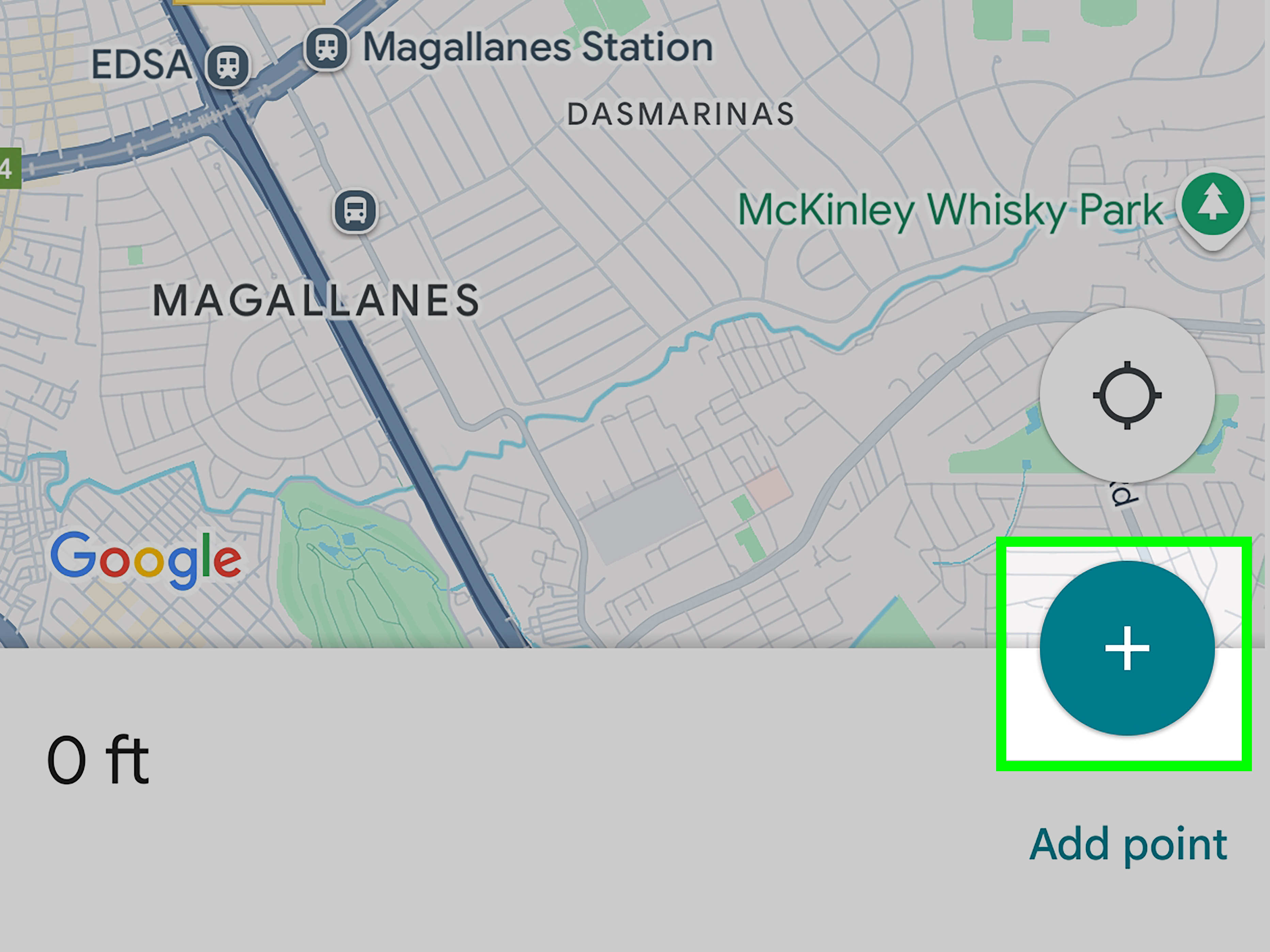
On Android or iPhone, open the Google Maps app. Touch and hold a spot on the map to drop a pin. Tap the place details at the bottom, select “Measure distance,” and move the map to add points. Continue adding points around your intended route until the total distance matches your goal.
This method works well for planning runs in parks, neighborhoods, waterfront paths, campuses, and vacation areas. It is especially useful when you are traveling and want to know whether that “short scenic loop” is actually scenic or secretly a half marathon wearing sunglasses.
Method 2: Use Google Maps Timeline to Review a Run
Google Maps Timeline can help you look back at places and routes you visited, as long as Location History is enabled on your Google account and device. Timeline is not a dedicated workout log, but it can be useful when you want to review where you went after a run.
How Timeline Helps Runners
After a run, you may be able to open Google Maps Timeline and see your route, stops, and approximate movement history. This can help you remember which streets you took, how long you were out, or which route felt smoother. If you often run without starting a fitness app, Timeline may give you a general record of your route.
However, Timeline should not be treated as a precision running tool. It may classify movement differently, simplify parts of the route, or miss details depending on your phone settings, GPS signal, battery mode, and account preferences. It is helpful for memory. It is not your official Olympic timing chip.
Privacy Settings to Check First
Location History is off by default for many Google users and must be turned on for Timeline to work. Google also allows you to edit or delete Timeline data, manage auto-delete settings, and control where Timeline data is stored. Before relying on Timeline, check your Google account settings and decide whether you are comfortable saving location history.
For privacy-conscious runners, this matters. A route can reveal daily habits, home location, work location, favorite running paths, and the exact coffee shop where you pretend your post-run muffin is “recovery nutrition.” Use Timeline only if it fits your privacy comfort level.
Method 3: Combine Google Maps With Google Fit
If you want a more fitness-focused option while staying within free Google tools, use Google Fit with Google Maps. Google Fit can track activities such as walking, running, and cycling, and it can include maps for activities when location tracking is enabled.
Why Google Fit Is Better for Recording Runs
Google Fit is designed for health and activity tracking, while Google Maps is designed for navigation and place discovery. That means Google Fit is better for recording a run as an activity. It can help track distance, duration, and activity history, depending on your device and permissions.
To make maps appear with activities, open Google Fit, go to your profile and settings, and check location-tracking preferences. You may see an option to include maps for activities. Once this is enabled, Google Fit can record more useful running information than Google Maps alone.
Best Use Case
Use Google Maps to plan the route, then use Google Fit to record the workout. After the run, compare the planned distance with the recorded distance. If the difference is small, great. If the difference is enormous, either GPS had a bad day or you accidentally discovered a wormhole behind the grocery store.
Method 4: Create a Custom Running Route With Google My Maps
Google My Maps is a free tool that lets you create custom maps with routes, markers, lines, and notes. It is especially helpful for runners who like planning repeatable routes, race-day logistics, group runs, or scenic loops.
How to Build a Route in Google My Maps
On a desktop computer, open Google My Maps and create a new map. Give it a clear name such as “Saturday 5K Loop,” “Easy Neighborhood Run,” or “Long Run With Water Stops.” Add your start point, draw lines along your route, and place markers for bathrooms, water fountains, parking, hills, or turnaround points.
You can create layers for different route lengths. For example, one layer can show a 2-mile beginner loop, another can show a 5K route, and another can show a 6-mile long run. This is useful for runners who want options depending on energy level, weather, or how loudly their knees are filing complaints.
When My Maps Works Best
My Maps works best for planning and reference. It is not the same as live turn-by-turn running navigation, but it is excellent for saving custom routes and sharing them with friends. If you lead a running group, coach beginners, or simply like having a visual plan, My Maps is one of the most underrated free tools available.
Method 5: Use Google Maps Location Sharing for Safety
Location sharing is one of the most practical Google Maps features for runners. It allows you to share your real-time location with a trusted person for a chosen period. This is useful if you run alone, train before sunrise, explore unfamiliar areas, or do long routes where someone may want to know you are safe.
How to Share Your Location
Open Google Maps, tap your profile picture or initial, choose “Location sharing,” and start a new share. Select the person or copy a link, then choose how long to share your location. You can stop sharing at any time.
A simple safety routine might look like this: before your run, share your live location with a family member for one hour. Tell them your planned route and expected finish time. When you get home, stop sharing. It takes less than a minute and adds peace of mind.
Safety Tips for Better Runs
Use well-lit routes, wear reflective gear in low light, carry identification, and avoid high-traffic roads when possible. When running on roads, stay alert and do not assume drivers see you. Technology helps, but common sense is still the best free safety app ever released.
Method 6: Save Useful Running Spots in Google Maps
Google Maps lets you save places to lists. For runners, this is incredibly handy. You can save parks, trailheads, water fountains, public restrooms, parking areas, running tracks, scenic viewpoints, and post-run breakfast spots. Yes, pancakes count as route motivation.
Useful Lists to Create
Create lists such as “Best Running Routes,” “Water Stops,” “Safe Evening Runs,” “Vacation Run Ideas,” or “Race Day Parking.” When you travel, search for nearby parks and trails, read reviews, check photos, and save promising places before you arrive.
This method is especially helpful for business travelers, college students, digital nomads, and anyone who wants to keep running without spending 30 minutes standing on a sidewalk wondering which direction looks least suspicious.
Best Free Tools to Use With Google Maps
Google Maps becomes more powerful when paired with other free running tools. Each option has strengths, and the right choice depends on how much data you want.
Google Fit
Google Fit is a good choice for simple activity tracking. It is useful for runners who want basic distance, duration, and activity history without joining a social fitness network.
Strava
Strava is popular for runners and cyclists who enjoy GPS tracking, route maps, segments, leaderboards, and social sharing. The free version is enough for many casual runners, while advanced training features may require a paid subscription.
Nike Run Club
Nike Run Club is a strong free running app with GPS tracking, guided runs, challenges, and training support. It is especially friendly for beginners because it offers motivation without making the app feel like a spreadsheet in running shoes.
MapMyRun
MapMyRun is built around route tracking, pace, distance, and running logs. It is useful for runners who want an app focused specifically on mapping and improving runs.
ASICS Runkeeper
Runkeeper offers GPS tracking, goals, training plans, and workout history. It is a practical choice for runners who want structured progress without buying a running watch right away.
How to Plan a 5K Route With Google Maps
Let’s use a specific example. Suppose you want to create a 5K route near your home. A 5K is 3.1 miles, which is long enough to feel like a real workout but short enough that your shoes will not start asking legal questions.
Step-by-Step Example
First, open Google Maps on your computer. Right-click your starting point and select “Measure distance.” Click along sidewalks, quiet streets, park paths, or bike-friendly areas. Keep adding points until the route reaches about 3.1 miles. Try to make the route practical by avoiding dangerous intersections, poorly lit streets, or areas with no shoulder.
Second, check the route in Satellite View or Street View. Look for sidewalks, traffic, construction, trail entrances, and places where the map may not show real-world obstacles. Third, save key points such as the start, turnaround, restroom, or water fountain. Finally, send the route to your phone or recreate it in Google My Maps for future reference.
Tips for More Accurate Run Tracking
GPS is useful, but it is not magic. Tall buildings, dense trees, tunnels, weak signal, low battery mode, and phone placement can affect tracking accuracy. If you keep your phone buried deep in a backpack, the signal may be less reliable than if it is in an armband or running belt.
Improve GPS Results
Before starting a run, make sure location permissions are enabled, battery saver is not blocking GPS, and your app has time to lock onto your location. Start recording while standing still for a few seconds. After the run, review the map and check whether the route looks realistic.
If your recorded route shows you running through a lake, across rooftops, or directly through a shopping mall, do not panic. GPS drift happens. Unless you actually sprinted through a fountain, treat the data as an estimate.
Common Mistakes to Avoid
Using Driving Directions for a Running Route
Driving routes are not always runner-friendly. They may send you along busy roads, ignore pedestrian paths, or skip park trails. Use walking directions, manual distance measuring, or custom maps instead.
Trusting Estimated Time Too Much
Google Maps walking times are not personalized to your running pace. Your actual time depends on fitness, terrain, stops, weather, traffic lights, hills, and whether you pause to admire a dog. Use Google Maps for route distance, then use a running app for pace.
Forgetting Privacy and Safety
Do not publicly share exact routes that reveal your home address or daily routine. If you post running maps online, crop or hide the start and finish points. Many running apps offer privacy zones, but Google Maps screenshots may not.
of Real-World Running Experience: What Actually Works
After using Google Maps as part of a running routine, the biggest lesson is that it shines before and after the run more than during the run. The best workflow is simple: plan with Google Maps, record with a fitness app, review afterward, and adjust the route for next time. That may sound basic, but basic is often what keeps a running habit alive.
For beginners, Google Maps removes one of the most annoying barriers: uncertainty. When someone starts running, they often do not know what one mile feels like, where a safe loop begins, or how far the local park path really is. Measuring a route ahead of time helps set realistic expectations. Instead of leaving the house with vague ambitions and returning emotionally defeated by a surprise hill, you can choose a route that matches your current fitness.
One practical experience is building “comfort routes.” These are familiar loops that you can repeat without thinking too much. For example, create a 1-mile recovery route, a 3-mile weekday route, and a 5-mile weekend route. Save the starting points and key turns in Google Maps or My Maps. When motivation is low, you do not have to make decisions. You just pick the route and go. Decision fatigue is real, and it wears running shoes.
Another useful habit is checking Street View before running somewhere new. This helps you spot sidewalks, narrow shoulders, confusing intersections, or trail entrances. A route may look perfect from the map view but feel uncomfortable in real life if it runs beside fast traffic or lacks lighting. Street View is not always current, but it gives a helpful preview.
For travel, Google Maps is even more valuable. Before arriving in a new city, search for parks, waterfront paths, college campuses, and greenways near your hotel. Save two or three possible routes. Also save a backup indoor option such as a gym or hotel treadmill, because weather enjoys ruining confident plans. Location sharing is especially useful when running in unfamiliar places. Send your live location to someone you trust and tell them when you expect to return.
The best experience comes from not expecting Google Maps to be something it is not. It is not a coach. It is not a race timer. It will not celebrate your negative splits or gently roast you for skipping hill day. But it is excellent at answering important questions: Where can I run? How far is this route? Is there a safer street nearby? Where is the trailhead? Can someone see where I am?
For casual runners, that is enough. Use Google Maps as your planning dashboard and safety companion. Pair it with Google Fit, Nike Run Club, Strava, MapMyRun, or Runkeeper when you want proper workout stats. Together, these free tools can support a strong running routine without buying expensive gear. And yes, you can still reward yourself afterward. The map may track the miles, but it does not judge the bagel.
Conclusion
Google Maps is one of the easiest free tools for planning and reviewing running routes. While it does not replace a dedicated running tracker, it can help you measure distance, build custom routes, save useful running spots, share your location, and explore safer paths. For the best results, use Google Maps before your run to plan distance and route safety, then use Google Fit or a free running app to record the workout itself.
If you are new to running, start with simple loops and repeatable routes. If you are more experienced, use Google My Maps to organize long runs, race routes, or travel workouts. Either way, the goal is the same: spend less time guessing and more time moving. Your legs will still do the hard work, but at least your map will know where you are going.
Note: This article is based on current publicly available information from Google help resources and reputable running, fitness, and safety sources. No source-link markup or citation placeholders have been inserted, so the HTML is ready for web publishing.