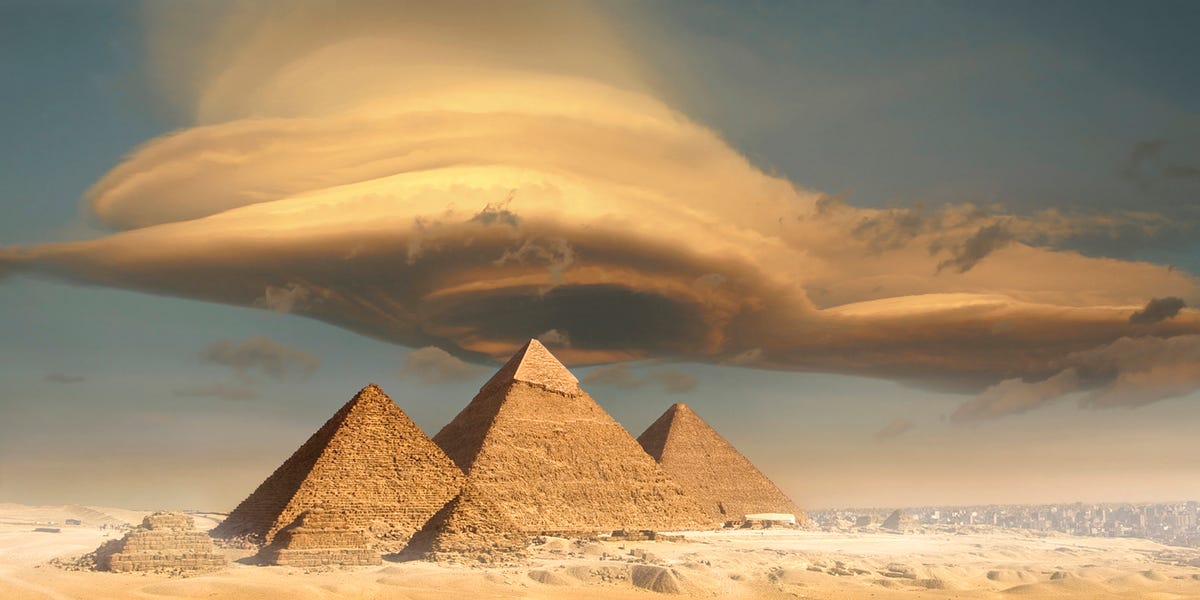
For centuries, the Great Pyramid of Giza has inspired a familiar question: How did ancient Egyptians move an enormous quantity of stone to a desert plateau without trucks, cranes, diesel engines, or a conveniently placed hardware store?
A growing body of archaeological and environmental evidence suggests that the answer begins with a landscape that no longer exists. During the age of pyramid building, the Nile was not confined to its modern channel. It divided into branches, bays, canals, marshes, and harbor basins that reached much closer to the royal construction sites.
In 2024, researchers mapped a major extinct channel running beside dozens of Egyptian pyramids. They named it the Ahramat Branch, using the Arabic word for “pyramids.” Buried beneath farmland and desert sand, this ancient branch of the Nile may help explain why pyramid fields were concentrated along the edge of the Western Desert and how workers transported stone, supplies, and people to the Great Pyramid.
The discovery does not settle every debate about pyramid construction. It does, however, replace a misleading image of workers hauling every block across miles of dry desert with a much more practical picture: a sophisticated construction network supported by river transportation, engineered harbors, canals, organized labor, and excellent project management.
Meet the Ahramat Branch, Egypt’s Lost Pyramid Waterway
The Ahramat Branch once flowed along the western side of the Nile floodplain between the Giza Plateau and the region near Lisht. Researchers reconstructed approximately 40 miles, or 64 kilometers, of the former channel. It bordered 31 known pyramids built over many centuries, from the Old Kingdom through the Second Intermediate Period.
The mapped channel lay roughly 1.5 to 6.4 miles west of the modern Nile. Estimates suggest that its visible surface channel was between about 650 and 2,300 feet wide and approximately 6 to 26 feet deep. At one surveyed location, geophysical evidence revealed a much deeper buried channel structure extending at least 82 feet below the surrounding floodplain.
In other words, this was not a decorative stream where a royal duck might enjoy a peaceful afternoon. It was a substantial waterway comparable in width to portions of the modern Nile and capable of serving as a major transportation corridor.
Why the Branch Was Difficult to Find
The waterway did not remain as an obvious dry trench. Over thousands of years, it migrated, filled with sediment, and disappeared beneath cultivated fields, towns, roads, and windblown sand. Ordinary aerial photographs could not reveal much because vegetation and modern development concealed the channel’s surface expression.
Researchers therefore used radar satellite imagery, historical maps, elevation data, ground-penetrating radar, electromagnetic tomography, and deep sediment cores. Different techniques supplied different pieces of the puzzle. Radar identified subtle variations in terrain, geophysical surveys detected buried structures, and sediment samples confirmed that the suspected channel contained river-deposited sand, mud, shells, and other materials.
The result was the first large-scale map connecting a major lost branch of the Nile with the long chain of pyramid complexes along the desert margin. It was less like finding a forgotten creek and more like discovering that an ancient interstate highway had been hiding beneath the cornfields.
Why the Lost Nile Branch Matters to the Great Pyramid
The Great Pyramid was built for Pharaoh Khufu during Egypt’s Fourth Dynasty, around the middle of the third millennium B.C. Originally standing about 481 feet tall, it was the largest pyramid ever constructed and remains the only surviving Wonder of the Ancient World.
Its location appears barren today, but the ancient setting was more complicated. According to the Ahramat study, the Great Pyramid may have been directly connected to the main river branch. The neighboring complexes of Khafre, Menkaure, and Queen Khentkaus were associated with a smaller lagoon-like waterway that researchers call the Giza Inlet.
This watery landscape would have brought boats much closer to the building sites than the modern Nile does. Instead of dragging every imported block across a wide stretch of desert, crews could move cargo by river, unload it near a valley temple or harbor, and complete the final portion of the journey overland.
The Causeways Point Toward the Water
A pyramid was not a lonely stone triangle dropped in the desert. It belonged to a larger ceremonial complex that usually included a mortuary temple beside the pyramid, a valley temple near the floodplain, and a raised causeway connecting the two.
The new mapping found that many pyramid causeways run roughly perpendicular to the Ahramat Branch and end near its former banks. Five surviving valley templesincluding those associated with the Bent Pyramid, Khafre, Menkaure, Sahure, and Pepi IIstand next to the reconstructed waterway or one of its connected inlets.
Valley temples had religious functions, but their waterfront locations also made them practical arrival points. Boats carrying officials, workers, offerings, food, equipment, and construction materials could dock near the lower temple. Cargo and ceremonial processions could then travel up the causeway toward the pyramid plateau.
The architecture therefore preserves a map of the lost river. The causeways are almost like ancient arrows saying, “The harbor used to be over here.”
Stone Transportation Was a River-Based Operation
Much of the Great Pyramid’s core limestone came from quarries on or near the Giza Plateau. However, higher-quality white casing limestone was transported from Tura, on the eastern side of the Nile. Granite used in chambers and structural spaces came from the Aswan region, hundreds of miles to the south.
Moving those materials by boat was dramatically more efficient than pulling them over dry ground for the entire journey. Barges could use the main Nile system before entering a branch, canal, harbor basin, or sheltered inlet close to the pyramid construction zone.
The Diary of Merer Provides Written Evidence
One of the most valuable pieces of evidence is the Diary of Merer, part of a collection of ancient papyri discovered at Wadi el-Jarf. Merer was an official supervising a work crew near the end of Khufu’s reign.
His logbook describes journeys transporting fine limestone from Tura to the area of the Great Pyramid. The crew traveled by boat through waterways and spent time near the Giza construction site. This is not a modern guess based on a suspiciously pyramid-shaped cloud. It is an administrative record written by someone involved in the operation.
The papyri do not describe every stage of construction, but they confirm that stone deliveries to Khufu’s project depended on water transportation. Combined with evidence for harbors and the newly mapped Ahramat Branch, Merer’s account becomes part of a coherent logistical system.
Earlier Environmental Evidence Supports the Waterway Theory
The Ahramat research builds on earlier studies of the ancient Giza floodplain. In 2022, scientists analyzed fossil pollen preserved in sediment cores to reconstruct changes in a waterway commonly called the Khufu Branch.
Plants growing near permanent water produce different pollen patterns from vegetation adapted to drier environments. By studying those microscopic grains, researchers estimated that water levels remained high enough during the reigns of Khufu, Khafre, and Menkaure to support navigation near the Giza pyramid harbor.
The pollen study focused closely on the Giza area, while the Ahramat project mapped a much longer river system beside multiple pyramid fields. Together, the findings strengthen the conclusion that the pyramid builders worked within an active waterscape rather than the dry environment visitors see today.
The Nile Explains Logistics, Not Every Construction Mystery
The discovery of an ancient Nile branch helps explain how heavy materials reached the pyramid sites. It does not reveal exactly how workers raised every block into its final position.
Once stones arrived at the harbor, they still had to be unloaded, shaped, transported uphill, and placed with extraordinary accuracy. Archaeologists continue to study combinations of sledges, ramps, ropes, levers, lubricated surfaces, counterweights, and carefully coordinated labor.
The river should therefore be viewed as one essential component of a larger engineering system. It reduced the most exhausting part of long-distance transportation, but it did not assemble the pyramid like a giant aquatic delivery drone.
Human Organization Was the Real Superpower
Excavations near Giza have uncovered a large settlement associated with the pyramid workforce. Archaeologists have found evidence of bakeries, food production, storage facilities, workshops, administrative activity, and housing.
Raw materials and provisions arrived from different parts of Egypt, especially during periods when Nile flooding improved access to the site. The construction zone functioned as a planned industrial and administrative center supported by specialized workers, rotating labor groups, officials, boat crews, craftspeople, and food suppliers.
This evidence challenges the popular image of a chaotic mass of people pushing stones while someone in a gold hat shouts instructions. Building the Great Pyramid required scheduling, taxation, transportation, accounting, quarry management, food distribution, surveying, and quality control. In modern language, it was a national infrastructure project with unusually ambitious deliverables.
Why Did the Ahramat Branch Disappear?
Researchers have not identified a single date when the branch abruptly stopped flowing. Its disappearance was probably a gradual process driven by several environmental changes.
The Nile naturally shifts across its floodplain. Over time, the Ahramat Branch migrated eastward, leaving abandoned bends and channels behind. Gradual tilting of the landscape caused by geological activity may have encouraged that movement toward lower ground.
Climate also played a role. As the region became more arid, reduced rainfall lowered river discharge. A weaker current carried less water and became less capable of flushing away sediment. Windblown desert sand accumulated near the western edge of the floodplain, helping the branch silt up.
Periods of severe drought near the end of the Old Kingdom and during the First Intermediate Period likely accelerated this transformation. Connected inlets withdrew, wetlands shrank, and the once-important transportation corridor slowly became a buried riverbed.
Pyramid Locations Record Changes in Water Level
The positions of pyramids from different dynasties may preserve clues about the movement of the river. During periods of higher water, builders could select elevated sites farther into the desert because navigable inlets still reached them. When water levels fell or the channel shifted, later pyramids tended to be constructed closer to the changing floodplain.
The Bent and Red Pyramids at Dahshur, for example, appear surprisingly remote from modern waterways. Radar evidence indicates that an ancient inlet once extended toward the Bent Pyramid’s valley temple. Middle Kingdom pyramids in the same broad region were built farther east, consistent with an eastward migration of the river system.
Royal architects were not randomly placing pyramids wherever the desert looked photogenic. They were selecting locations that balanced stable high ground, religious symbolism, visibility, building resources, and access to water.
A More Complete Picture of Ancient Egypt
The Ahramat Branch changes more than the story of pyramid construction. It helps researchers reconstruct the economic landscape surrounding the monuments.
A major river branch would have connected settlements, workshops, agricultural estates, temples, ports, and administrative centers. Areas that appear empty today may once have supported busy waterfront communities. Archaeologists can use the new map to identify promising locations for buried settlements, valley temples, harbor facilities, and other structures.
This knowledge also has modern value. Some remains may lie beneath agricultural land or rapidly expanding urban areas. Mapping ancient channels can help heritage authorities determine where archaeological surveys should occur before construction projects disturb undiscovered sites.
The same combination of radar imagery, elevation modeling, geophysical testing, and sediment analysis could locate other buried waterways in dry regions around the world. The Ahramat Branch is therefore both an archaeological discovery and a demonstration of how modern Earth science can recover landscapes erased by natural and human change.
Experiencing the Lost Nile Landscape
The most rewarding way to engage with this discovery is to stop viewing the Great Pyramid as an isolated object. Photographs usually frame it against a clear desert sky, removing the farms, settlements, roads, quarries, temples, and waterways that gave the monument its original context. That clean composition looks magnificent on a poster, but it edits out much of the story.
Begin instead with a map of the Giza Plateau. Locate the Great Pyramid, its eastern temple, the surviving traces of its causeway, the probable valley temple area, and the lower floodplain. Then trace an imaginary route eastward toward the reconstructed Ahramat Branch. The distance between monument and river suddenly becomes manageable, especially when compared with the modern separation between the pyramids and the Nile.
Next, imagine following a shipment of fine limestone. The blocks are quarried at Tura and moved toward the water. A crew loads them onto boats, records the delivery, and navigates through a transportation system shaped by flood levels and seasonal conditions. The vessels approach Giza through a branch or canal and enter a protected harbor area. Workers unload the stone, transfer it to sledges, and begin the final climb toward the construction zone.
This mental journey transforms the pyramid from a mysterious pile of blocks into the center of a living supply chain. Along the waterfront, crews repair boats, handle ropes, inspect cargo, and wait for favorable water. Nearby, administrators count deliveries while laborers prepare food, sharpen tools, shape stone, and organize the next shift. One suspects that ancient project meetings were also longer than necessary, although the papyri remain tactfully silent on that subject.
The experience becomes even more vivid when looking at historic photographs of Nile flooding near Giza. These images do not show the Ahramat Branch during Khufu’s reign, but they demonstrate how dramatically water can alter the appearance of the landscape. Reflections replace dust. Boats become practical. Elevated desert ground looks like a deliberate choice rather than an inconvenient obsession.
At the pyramid complexes, pay particular attention to the causeways and valley temples. They are often overshadowed by the pyramids, yet they connect royal architecture to the lost waterscape. A causeway was a ceremonial route, but it was also a physical link between a river landing and the monument above. Standing conceptually at its lower end allows you to picture arriving by boat rather than tour bus.
The discovery also offers an excellent experience for students and families using satellite maps at home. Compare the narrow green floodplain with the surrounding desert. Mark Giza, Abusir, Saqqara, Dahshur, and Lisht. The north-south arrangement of pyramid fields begins to resemble a river corridor. Once the ancient channel is added, a pattern that looked puzzling becomes logical.
Most importantly, following the ghost river encourages respect for ancient Egyptian skill. The explanation does not make the Great Pyramid less extraordinary. It makes the achievement more human and therefore more impressive. The builders succeeded not because they ignored geography, but because they understood it. They used water, seasons, stone, labor, and carefully designed infrastructure as parts of one coordinated system.
The Ahramat Branch reminds us that archaeological sites are frozen moments inside moving landscapes. Rivers shift, deserts expand, harbors vanish, and cities cover old shorelines. The pyramid stayed in place while the world around it changed, leaving future researchers to reconstruct the missing scenery grain by grain, radar image by radar image, and pollen sample by pollen sample.
Conclusion
The ancient Ahramat Branch of the Nile offers one of the clearest explanations yet for the geographic pattern of Egypt’s pyramid fields. Its proximity to the Great Pyramid and dozens of other monuments, together with the alignment of causeways, valley temples, harbor evidence, sediment records, and the Diary of Merer, reveals a landscape organized around water transportation.
The river did not lift stones to the summit or eliminate the need for ramps, tools, skilled workers, and precise planning. It solved a different problem: moving people and heavy cargo efficiently across Egypt and delivering them close to the construction sites.
Seen in this context, the Great Pyramid is not an inexplicable object stranded in the desert. It is the surviving centerpiece of a vanished transportation and settlement network. The stones remained, the river moved on, and modern science is finally putting the two back together.
Research note: This article synthesizes peer-reviewed research and institutional material from Communications Earth & Environment, the Proceedings of the National Academy of Sciences, the University of North Carolina Wilmington, Ancient Egypt Research Associates, Harvard’s Digital Giza Project, the Metropolitan Museum of Art, Smithsonian Magazine, Live Science, Popular Science, and related scientific reporting.